Symkala: Socio-Geographic Mapping Derived from Human REasoning of Abstract Qualitative Narratives and IMagery
Carnegie Mellon University, Symkala LLC 2014-2016

Mark Twain’s pub crawl extracted from “Innocent’s Abroad”
Problem
Geographic Information Systems (GIS) are used in many industries to understand the complex spatial relationships of economics, society, and the environment. They are part of the standard toolkit of any architect, urban planner, and urban designer, to inform the design of new urban spaces and environmental interventions. Today's GIS information systems maintain an antiquated workflow, interface design, and data requirements.
Above: The Industry Standard GIS Interface and User Experience
GIS drives decisions in governments and businesses around the world.
The UX design hasn’t changed in decades.
What if we re-imagine digital maps as an interactive experience, shaped by native human reasoning and sense-making, not database-driven logic?
If GIS was approached from a new point of view - not that of the 'analyst' - but from the point of view of the analyzed subject, what would be the result? If the platform did not maintain traditional data requirements such as shape files but could leverage unstructured information such as images and text, how would that work?
This work embodies an attempt to change the entire model of GIS, thus to transform the design process that shapes the built environment.
UX / UI Experimentation Process

Mockup (Above) for Current UX/UI Schema
In tandem with previous research effort concerning machine learning, mapping, and forensics, I have additionally conducted human centered research with urban developers, humanitarian workers, government employees, intelligence experts, and geographers.
Channeling the design research into building the platform massive challenge requiring a bigger team. Geoffrey Morgan supplied computational analytical abilities, Will Milner has led the core platform coding, Rachel Chang and Jeffrey Houng assisted in rapid prototyping and UI Design. The entire process has been conducted with zero funding.
ur team methods include site-based user research, qualitative interviews, design workshops, and speed dating with paper prototypes. Using an agile development process, software is constructed via biweekly sprints (captured in grid of images, click to expand).


Hi Fidelity Prototype
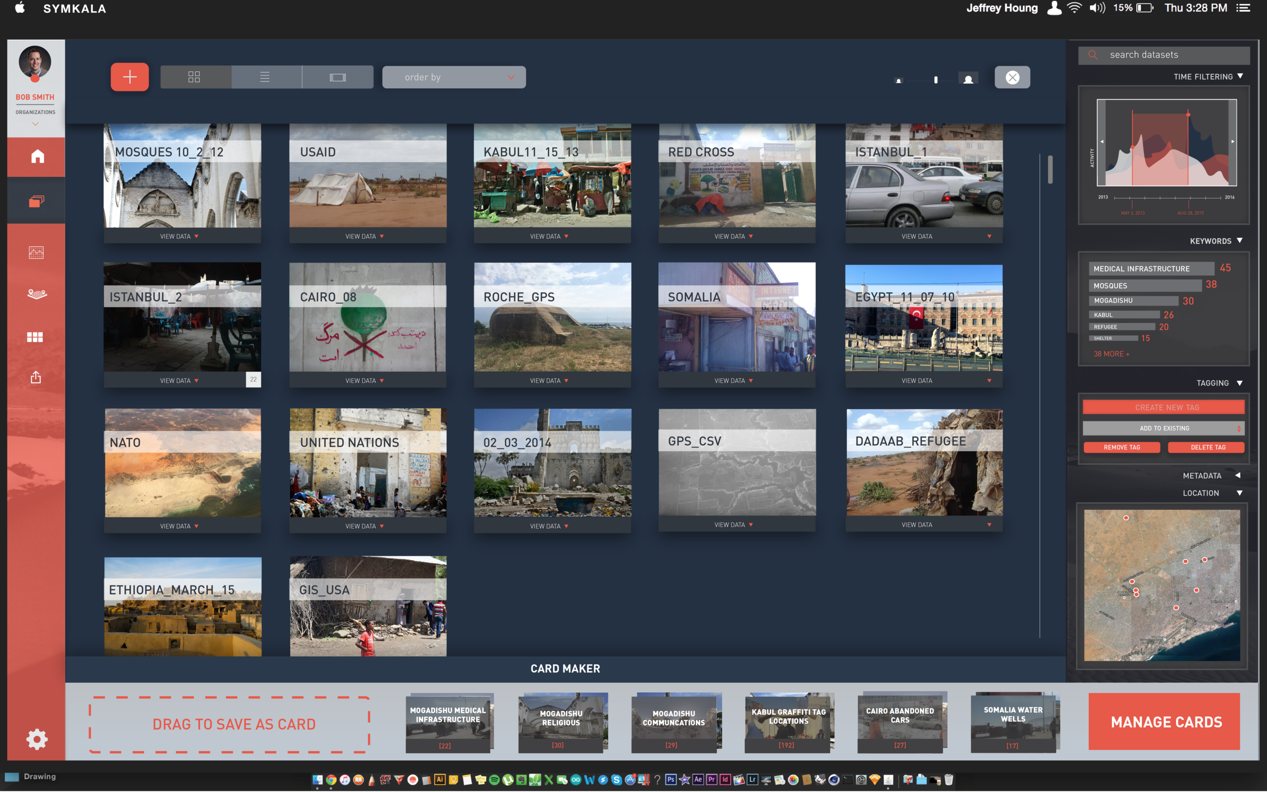
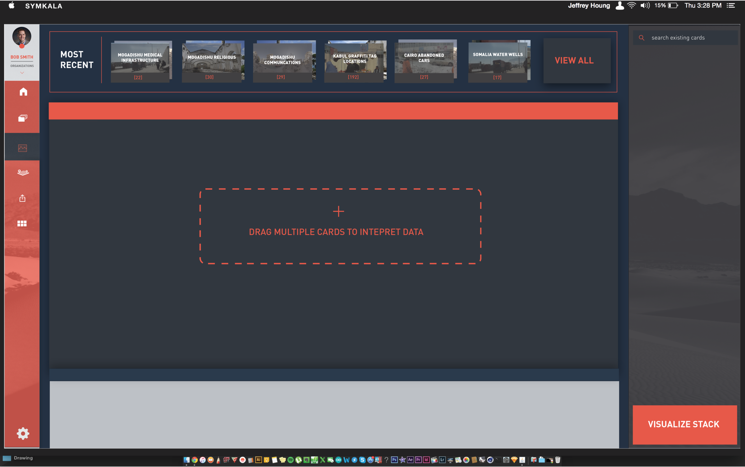
The Symkala GIS platform is a radical new take on GIS technologies. Inspired by batch processing platforms for multimedia such as Apple Aperture and Adobe Lightroom, Symkala is designed around the need for teams to conduct phased workflows of data preparation, synthesis, visualization, and simulation. The image below is a screen shot of the active build of Symkala, built on Amazon AWS from Python and Java. It includes the use of machine learning for rapid urban systems mapping (Research Project I) and with linguistic analysis can extract entity to geography relationships from text data. It then identifies the location coordinates of the geographic place.

Currently Deployed Build (Above) As an iterative step that permits use testing but also as a complete user experience, Future Build (Top Right) Hi-Fidelity Prototype of Text Processing Window for GIS Analytics
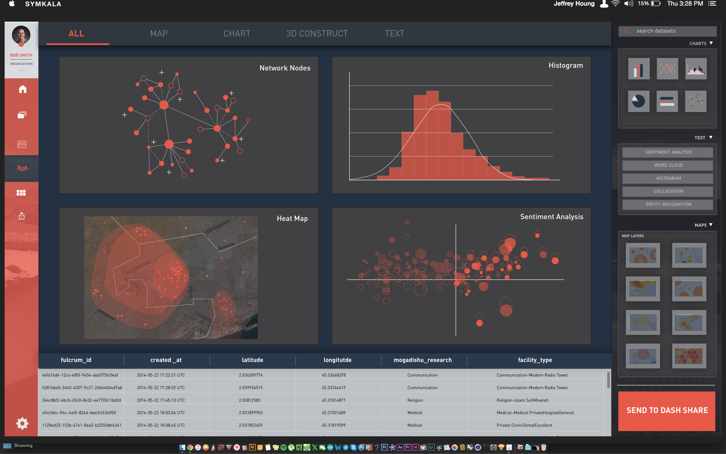
Sample Analytical Outputs

Three visualizations created by Symkala from photo (top left), CSV (right), and fused data sources (bottom left)